The main objective of the FAROS project is to launch an innovative service concerning precision agriculture with the creation of maps produced by earth observation data. Through the integration of satellite data derived from the new Copernicus constellation and in particular from the upcoming satellite launch, Sentinel 2 combined with GIS technologies FAROS intends to develop an agricultural information system allowing even the less experienced users to employ maps derived from satellite data within their production process to optimize production, decrease the pesticides and herbicide use and respect the environment.
Winner of phase 1 SME Instruments
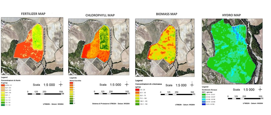
The strenght maps allow you to monitor crops force with considerable detail, by “Photographing” the vegetative state and quantifying the photosynthetically active biomass. For each field the map use a chromatic scale in n shades, from red to dark green, to indicate n different levels of vegetative strenght (red: minimal vegetative force; dark green: maximum vegetative force). In this way, each field or sector of it is divided into n classes of force, each one equal to approximately 1 / n of the entire parcel surface.
For each parcel, the maps are produced in 2, 3, 5 and 10 classes, in order to provide the user with a wide range of predefined opportunities concerning this technology different possible repercussions and field applications.
These maps supply to:
- obtain a production increase
- fertilizations best manage
- be aware of risk areas
- increase products quality
For information: http://faros.iptsat.com/


